
.jpg)
Kushigata Mountain Range (Niigata Prefecture) Complete Guide | Charm and Mountaineering Information of Japan’s Smallest Mountain Range
What is the Kushigata Mountain Range? Overview of Japan’s Smallest Mountain Range
The Kushigata Mountain Range (くしがたさんみゃく) is Japan’s smallest-scale mountain range, extending north-south from Tainai City to Shibata City in Niigata Prefecture. Located in an area sandwiched between the Tainai River to the north and the Kaji River to the south, it spans approximately 13.5 km in straight-line distance.
The highest peak is Kushigata Mountain at 568.0 m elevation (567.9 m according to some sources). Though it is a low mountain with an average elevation of less than 300 m, it is an official mountain range explicitly marked as “Kushigata Mountain Range” on the Geospatial Information Authority of Japan’s 1:25,000 topographic maps. Bounded by National Route 290 and National Route 7 on the east and west, it is characterized by its convenient access as it is located on the eastern edge of the Echigo Plain.
This mountain range is known as “Japan’s smallest mountain range” and attracts attention from mountaineers both within and outside Niigata Prefecture as a user-friendly mountainous area where even beginners can enjoy ridge traverses.
Geographical Features and Composition of the Kushigata Mountain Range
Major Mountains
The principal mountains composing the Kushigata Mountain Range are as follows:
- Kushigata Mountain: 568.0 m elevation (highest peak)
- Torisakayama: 438.2 m elevation
- Omine Mountain: 399.3 m elevation
These mountains line up in a north-south direction, and approximately 13.5 km of hiking courses are developed along the ridge. The relatively gentle terrain allows even beginner mountaineers to safely enjoy ridge traverses.
Geology and Fault Zone
The Kushigata Mountain Range Fault Zone is an active fault zone extending approximately 16 km in a north-northeast to south-southwest direction from Murakami City (former Arakawa Town) to Shibata City (former Kaji River Village) in Niigata Prefecture. It is composed of the Kaji Fault, Sakacho Vicinity Fault, and Kushigata Mountain Range Western Fault, and is monitored by the Earthquake and Tsunami Disaster Prevention Center.
The existence of this fault zone is an important element in understanding the formation process of the Kushigata Mountain Range and is closely related to its geographical position on the eastern edge of the Echigo Plain.
Natural Environment and Points of Interest of the Kushigata Mountain Range
Beech Forest and Forest Ecosystem
A magnificent beech forest spreads across the summit area of the Kushigata Mountain Range, maintaining a naturally rich forest environment. Despite the low elevation, luxuriant vegetation has developed, and one can observe the natural world through all four seasons.
The beech forest is a representative natural environment of Niigata Prefecture’s satoyama (semi-natural grasslands and shrublands adjacent to villages), serving as a habitat for diverse flora and fauna. Walking the mountain trails while enjoying forest bathing is a major appeal of the Kushigata Mountain Range.
Autumn Foliage Scenic Spot
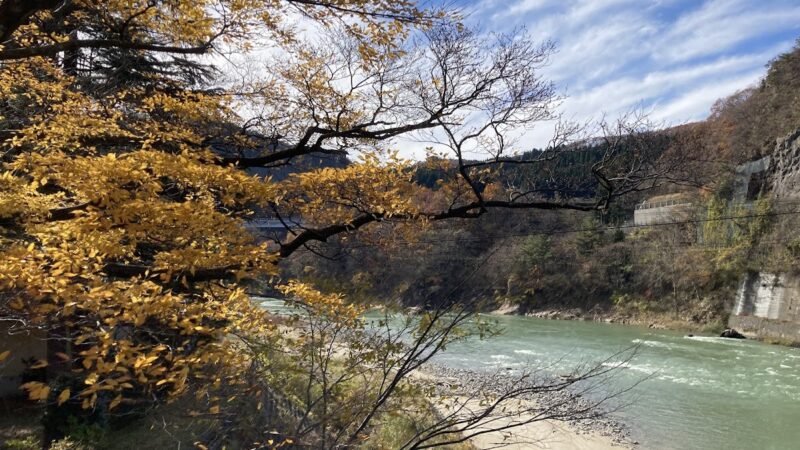
The Kushigata Mountain Range is also known as a scenic spot for autumn foliage. Typically from late October to mid-November, maples, Japanese maples, and beeches change color, enveloping the entire mountain in autumn colors.
Because of its low elevation, autumn foliage can be enjoyed relatively late into the season. A ridge traverse of the Kushigata Mountain Range in autumn is a luxurious experience that allows one to enjoy both foliage hunting and mountaineering simultaneously.
Historic Sites and Cultural Properties
The Kushigata Mountain Range is also called a “treasure trove of nature and historic sites,” with historical ruins and cultural properties scattered along the mountain trails. These mountains have long been objects of worship, and traces of mountain faith can be seen throughout.
Mountaineering Courses of the Kushigata Mountain Range and Required Time
Main Mountain Access Points
Multiple mountain access points are established for the Kushigata Mountain Range:
Sekisawa Trailhead (Osawa Ridge Trailhead)
The most frequently used trailhead, located about 10 minutes by car from Chuo Station on the JR Uetsu Main Line. It is adjacent to Sekisawa Forest Park, and parking facilities are well-developed. The climb from here to the summit takes approximately 1 hour 15 minutes.
Miyanoiri Trailhead (Hakuro Trailhead)
This trailhead serves as the southern starting point of the ridge traverse course. It can be accessed from the direction of White Bird Park.
Mountain God Route (via Forest Park)
A route using Sekisawa Forest Park, where relatively well-maintained mountain trails can be utilized.
Details of Ridge Traverse Course
Standard Ridge Traverse Course:
- Route: Sekisawa Trailhead (Osawa Ridge) → Kushigata Mountain → Torisaka Mountain → Omine Mountain → Miyanoiri Trailhead (Hakuro)
- Distance: Approximately 10.5–13.5 km
- Required Time: Approximately 6–8 hours
- Difficulty: Beginner-friendly
Walking along ridge trails that are well-maintained, there is little concern about losing the way, making it suitable for a first ridge traverse. A day hike to completion is possible, but a plan with plenty of time and physical stamina is necessary.
Round-Trip Mountaineering (Out and Back Course)
If a ridge traverse is difficult, a round-trip course from the Sekisawa Trailhead to the Kushigata Mountain summit is also recommended.
- Required Time: Approximately 2.5–3 hours round trip
- Elevation Gain: Approximately 400 m
From the summit, one can view the Echigo Plain and the Sea of Japan, allowing a full taste of mountaineering enjoyment in a short time.
Optimal Season for Mountaineering and Events
Mountain Opening Event
A mountain opening event is held annually on April 29 (Showa Day) for the Kushigata Mountain Range.
- 2025 Mountain Opening: April 29 (Tuesday, National Holiday)
- Content: Shinto ceremony, mountain opening climbing
At the mountain opening event, a safety prayer ceremony is conducted, and many mountaineers participate.
Mountaineering Season
Recommended Mountaineering Period: May–November
- Spring (May–June): New greenery is beautiful, and mountaineering can be enjoyed in the fresh air after snowmelt
- Summer (July–August): Because of the low elevation, heat protection is necessary, but the forest interior remains relatively cool
- Autumn (October–November): The most popular time, with autumn foliage season. Particularly late October to mid-November is peak viewing season
- Winter (December–March): Snow accumulates, and general mountaineering is not recommended
Access Methods and Parking Information
Public Transportation Access
Using JR Uetsu Main Line:
- Nearest Stations: Chuo Station (to Sekisawa Trailhead), Nakaura Station (to Miyanoiri Trailhead)
- From Chuo Station to Sekisawa Trailhead: Approximately 10 minutes by car (taxi use necessary)
Access by public transportation alone is difficult, so taxi use or ride-sharing with fellow mountaineers is recommended.
Automobile Access
Sekisawa Trailhead (Sekisawa Forest Park):
- Approximately 15 minutes from “Chuo IC” on the Nihonkai-Tohoku Expressway
- Using National Route 290
- Parking: Available (Sekisawa Forest Park Parking Lot)
Miyanoiri Trailhead:
- Approximately 20 minutes from “Chuo IC” on the Nihonkai-Tohoku Expressway
- Access from the direction of White Bird Park
- Parking: Available
For ridge traverse mountaineering, it is necessary to prepare two vehicles positioned at the trailhead and descent point respectively, or arrange a taxi in advance.
Mountaineering Precautions and Preparation
Equipment and Clothing
Though the elevation is low, it remains mountainous terrain. Prepare the following equipment:
- Hiking Boots: Hiking shoes or higher recommended
- Rain Gear: Essential for sudden weather changes
- Map and Compass: Smartphone GPS apps are also effective
- Drinking Water: 1 liter or more (approximately 2 liters for ridge traverse)
- Action Food: For energy replenishment
- Headlamp: To prepare for unexpected sunset
- First Aid Kit: Adhesive bandages, athletic tape, etc.
Mountain Climbing Registration
A registration box for climbing permits is installed at the trailhead. For safety in the event of an accident, always submit a climbing registration before entering. Online registration is also available.
Mountain Hut and Restroom Information
There are no mountain huts on the Kushigata Mountain Range. Day hiking is the standard. Restrooms are available near the trailhead, but there are none on the mountain trail, so it is important to use them beforehand.
Cellular Phone Reception
Reception is relatively good on ridges, but there are places where signals are lost in valleys. Inform family or acquaintances of your mountaineering plan in advance to prepare for emergencies.
Nearby Tourist Spots and Accommodations
Sekisawa Forest Park
A forest park adjacent to the Sekisawa Trailhead with camping and barbecue facilities. Ideal for rest before and after mountaineering, as well as outdoor activities for families.
White Bird Park
A park near the Miyanoiri Trailhead, known for the arrival of white swans during winter. One can enjoy nature observation together with mountaineering.
Hot Spring Facilities in the Tainai Area
Hot spring facilities in Tainai City are recommended to relieve fatigue after mountaineering:
- Tainai Hot Spring: A hot spring resort located along the Tainai River
- Royal Tainai Park Hotel: A resort hotel offering day-use bathing
Sightseeing in the Shibata Area
- Shibata Castle: A castle designated as a national important cultural property
- Tsukioka Hot Spring: One of Niigata Prefecture’s most representative hot spring resorts
How to Enjoy the Charm of Kushigata Mountain Range to the Fullest
Recommended Enjoyment for Beginners
- Start with Round-Trip Mountaineering: Experience the atmosphere of the mountain range with a round-trip course from the Sekisawa Trailhead to Kushigata Mountain summit
- Aim for Autumn Foliage Season: Late October to mid-November is particularly beautiful with autumn colors
- Participate in the Mountain Opening Event: Interaction with local mountaineers is also enjoyable
Challenges for Experienced Climbers
- Complete Ridge Traverse: Experience a sense of accomplishment with the 13.5 km ridge walk from north to south
- Trail Running: Well-maintained mountain trails are also suitable for running
- Enjoy Seasonal Changes: Visit in different seasons—spring, summer, and autumn—to observe nature’s transformations
Photography Points
- Summit Panorama: Views of the Echigo Plain, Sea of Japan, and surrounding mountains
- Beech Forest Scenery: Particularly beautiful forest landscapes can be captured during new growth and autumn foliage periods
- Ridge Trail Views: Varied scenery can be enjoyed from the ridge traverse route
Community Initiatives and Environmental Conservation
Environmental conservation and maintenance of mountain trails are conducted in the Kushigata Mountain Range by Tainai City, Shibata City, and Niigata Prefecture. Mountaineers should also pay attention to the following points to preserve this beautiful natural environment:
- Always take out trash: Aim to leave things “more beautiful than when you arrived”
- Do not leave marked trails: Stay on designated trails to protect vegetation
- Respect wildlife and plants: Collection and feeding are strictly prohibited
- No open flames: Open flames are prohibited outside designated areas to prevent forest fires
Inquiries and Related Information
Inquiries Regarding Mountaineering
Tainai City Tourism Association
- Address: 2-15 Shinwa-cho, Tainai City, Niigata Prefecture
- Telephone: 0254-47-2723
Shibata City Tourism Association
- Telephone: 0254-26-6789
Niigata Prefecture Shibata Regional Promotion Bureau
- Address: 3-3-2 Toyomachi, Shibata City, Niigata Prefecture
- Telephone: 0254-26-9113 (Regional Development Division)
Emergency Contact Information
- Police (Emergency): 110
- Fire and Ambulance: 119
- Shibata Police Station: 0254-27-0110
- Tainai City Fire Department: 0254-43-2119
Conclusion: Kushigata Mountain Range is a Mountain Area Enjoyable by Beginners
The Kushigata Mountain Range in Niigata Prefecture, characterized as Japan’s smallest mountain range, is a precious area where full-fledged ridge traverse mountaineering can be enjoyed. The approximately 13.5 km ridge trail with Kushigata Mountain at 568 m as the highest peak offers a mountaineering experience providing a sense of accomplishment while remaining accessible to beginners.
Spanning Tainai City and Shibata City, this mountain range possesses diverse charms including beautiful beech forests, expressions changing through the seasons, and panoramic views overlooking the Echigo Plain. Particularly from late October to mid-November during the autumn foliage season, maples and Japanese maples color the mountains, making it the most beautiful period.
Access is relatively convenient, approximately 15–20 minutes by car from the Chuo IC on the Nihonkai-Tohoku Expressway. From the Sekisawa Trailhead, the summit takes about 1 hour 15 minutes, making it ideal for day hiking. The mountain opening is held annually on April 29, with the mountaineering season running from May to November.
For those who wish to attempt their first ridge traverse, those who want to enjoy casual mountain walking, and those who want to fully experience Niigata Prefecture’s nature, the Kushigata Mountain Range is an ideal mountaineering spot. Featuring both the accessibility unique to Japan’s smallest mountain range and the pleasures of authentic mountaineering, be sure to visit the Kushigata Mountain Range.
-800x450.jpg)
-800x450.jpg)