Shirakami Mountains Komagatake Complete Guide|Spectacular Hiking Spot of World Heritage in Akita Prefecture
Shirakami Mountains Komagatake (Fujisato Komagatake), located in Fujisato Town, Yamamoto District, Akita Prefecture, is a mountain with an elevation of 1,158m and is known as the highest peak on the Akita Prefecture side of the Shirakami Mountains. Located in the southeastern part of the Shirakami Mountains, which is registered as a World Natural Heritage site, it continues to enchant hikers with its primordial beech forests, rich natural environment, and magnificent vistas from the summit.
This article comprehensively explains information you should know before visiting this mountain, from the charm of Shirakami Mountains Komagatake to hiking courses, autumn foliage information, and access methods.
About Shirakami Mountains Komagatake
Origin and History of Komagatake
Fujisato Komagatake, also called Taira Komagatake, is one of 16 Komagatake peaks throughout Japan. The origin of its name lies in the massive “black horse” snow pattern that appears on the mountainside during spring snowmelt. This snow pattern has long been cherished by local residents as a natural calendar announcing the beginning of agricultural work.
When April arrives, a horse-shaped negative snow pattern appears on the mountainside, and because this phenomenon served as an important indicator for agricultural timing, the mountain was named Komagatake. The area has long revered it as a mountain of fertility and abundance, and it has been treasured as a mountain deeply connected to the lives of local people.
Position within the Shirakami Mountains
The Shirakami Mountains span approximately 130,000 hectares across Akita and Aomori Prefectures and were registered as a World Natural Heritage site in December 1993 (Heisei 5). The world’s largest scale of pristine beech forests spreads across the region, maintaining a precious ecosystem where diverse fauna and flora inhabit and grow.
Komagatake is located in the southeastern part of the Shirakami Mountains and is the highest peak on the Akita Prefecture side. While not included in the core zone of the World Heritage site, it attracts many hikers as one of the representative mountains of the Shirakami Mountains through its rich natural environment and hiking appeal.
The main mountains on the Akita Prefecture side of the Shirakami Mountains are Fujisato Komagatake (1,158m), Futatsu-mori (1,086m), and Ko-dake (1,042m). All of these mountains are located in areas accessible to general hikers without requiring advance notification.
Elevation and Geographic Characteristics
At 1,158m elevation, Komagatake is located in northern Akita Prefecture near the border with Aomori Prefecture. It is classified as an intermediate-level hiking course and is popular as a mountain accessible for day hiking.
The mountain’s characteristics include primordial beech forests typical of the Shirakami Mountains up to mid-slope, followed by an open summit area offering panoramic views of the famous peaks of Northeast Honshu beyond the tree line. From the summit, hikers can enjoy vistas of the World Heritage beech forests, the Japan Sea, Mt. Iwaki, Mt. Shirakami, and other notable peaks, and the 360-degree panoramic view provides a profound emotional experience.
Attraction of Komagatake Hiking
Spectacular Beech Primordial Forest
The greatest charm of Shirakami Mountains Komagatake is the opportunity to experience firsthand the ancient beech primordial forest believed to have existed since around 8,000 years ago. Walking the hiking trail, one encounters giant beech trees hundreds of years old, surrounded by their overwhelming presence.
Beech forests are also called “green dams,” storing abundant water and supporting diverse ecosystems. Various alpine flowers grow on the forest floor, displaying different appearances with each season. Spring brings vivid fresh green, summer offers deep green shade, and autumn presents golden foliage, allowing enjoyment of the beauty of each season.
Walking through this primordial forest untouched by human hands allows one to touch nature in its original state, and you can feel through your body why the Shirakami Mountains received World Natural Heritage designation.
Alpine Plants of Tanawashiro Wetland
Along the Komagatake hiking route lies Tanawashiro Wetland, a beautiful wetland known as one of the rare wetland viewing spots in the Shirakami Mountains, where diverse alpine plants bloom in this precious location.
The wetland is positioned at high elevation and from early to mid-summer, various flowers bloom abundantly, entertaining hikers as a “wetland full of flowers.” The wetland is equipped with wooden walkways, allowing enjoyment of the wetland scenery without damaging the vegetation.
Different flowers can be seen depending on the season, including Japanese globeflower, cotton grass, and skunk cabbage, making the area popular for photography. The contrast between the serene atmosphere of the wetland and the delicate flowers provides a healing space that soothes hiking fatigue.
360-Degree Panorama from the Summit
Standing at the summit at 1,158m elevation, an awe-inspiring vista of the famous peaks of Northeast Honshu unfolds. On clear days, one can see Mt. Iwaki and Mt. Shirakami in Aomori Prefecture, and even the distant Japan Sea.
Particularly special is the ability to view from above the beech forests of the World Heritage core zone, a perspective uniquely available from Komagatake. The grand expanse of beech forests spreading like a green carpet is a spectacular landscape that can only be experienced in this place.
The summit is relatively spacious, allowing ample time to relax and enjoy the scenery. Wind can be strong on certain days, making warm clothing essential, but the views seen in the crisp air are incomparable.
Highlights of Autumn Foliage Season
Optimal Viewing Period and Color Information
The autumn foliage of Shirakami Mountains Komagatake is typically at its best from late September to mid-October each year. Because of its high elevation, the foliage begins earlier than in lowland areas, making it a location to experience autumn’s arrival first.
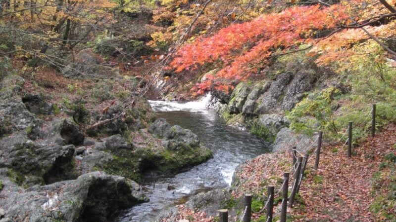
The color progression varies slightly year to year depending on temperature and weather, but generally the summit area begins to color in late September, with the mid-slope beech forests turning their most beautiful golden hue in early October. By mid-October, autumn colors spread to the base, enveloping the entire hiking trail in autumn tones.
The latest foliage information can be found on the websites of the Fujisato Town Tourism Association and the Shirakami Mountains World Heritage Center. It is recommended to check current coloring conditions before visiting.
Beauty of Beech Leaf Color Change
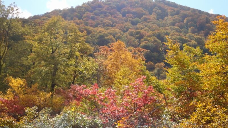
The star of Komagatake’s autumn foliage is undoubtedly the yellow leaf color change of beech trees. Rather than turning red like maple leaves, beech trees display a vivid yellow, which glows golden when struck by sunlight, creating a landscape worthy of the name “golden forest.”
Walking the hiking trail, the beech leaves overhead turn yellow, and dappled sunlight filters down like a golden shower. Fallen leaves accumulate underfoot, creating the sensation of walking on a yellow carpet.
The beech forest’s yellow foliage possesses a softer, warmer coloration compared to the red autumn colors of maple trees. The spectacle of the entire vast beech forest of the Shirakami Mountains turning golden is a rare autumn landscape found nowhere else.
Recommended Photography Spots
Komagatake during autumn foliage season offers multiple excellent photography locations.
Around Tanawashiro Wetland provides beautiful reflection photography of yellow foliage on the wetland’s water surface. The wooden walkway allows tripod-based photography.
Along the beech forest hiking trail, one can photograph the yellow-turned beech tree tunnel. Early morning soft light is particularly recommended, creating dramatic photos through the contrast of dappled sunlight and yellow foliage.
Near the summit, the golden beech forests spreading below can be photographed from a bird’s-eye view. Including the distant Japan Sea and surrounding mountains in the frame creates photos with impressive scale.
For photography, lighting conditions vary significantly with weather and time of day, so aiming for early morning or evening angled light produces dramatic results.
Hiking Courses and Duration
Kuroishi Trailhead Course (Shortest Route)
The course from Kuroishi Trailhead is the most popular and shortest-distance route for Komagatake hiking. One way takes approximately 2 hours, with round-trip requiring about 4 hours, making it ideal for day hiking.
Course Overview:
- Trailhead elevation: approximately 400m
- Summit elevation: 1,158m
- Elevation gain: approximately 750m
- One-way distance: approximately 3.5km
- One-way duration: approximately 2 hours
- Difficulty level: Intermediate
From the trailhead to Tanawashiro Wetland, the route ascends gradually through primordial beech forests. Beyond the wetland, the gradient progressively increases, and once above the tree line, the trail becomes rocky and steeper. The final approach to the summit becomes steep, but with no chain sections or dangerous areas, even inexperienced hikers can successfully complete it.
Other Hiking Routes
Several hiking routes exist besides the Kuroishi Trailhead.
The Gatadai Trailhead Course is a route from the Gatadai Natural Observation Educational Forest, allowing enjoyment of beech forest scenery while hiking. The distance is longer than the Kuroishi course, requiring approximately 3 hours one way.
The Kasuuge Trailhead Course is the longest route, taking approximately 3.5 hours one way, but is recommended for those seeking quiet mountain walking.
All courses allow for day hiking, but choosing the appropriate route according to fitness level and experience is important. For first-time hikers or those with limited fitness, the shortest Kuroishi Trailhead course is recommended.
Hiking Difficulty and Precautions
Komagatake is classified as an intermediate-level mountain, but the hiking trail is relatively well-maintained, making it feasible for those with limited hiking experience.
Physical Demands: Ascending 750m in elevation gain requires considerable fitness. Those who regularly exercise can manage the hike, but taking frequent breaks and hiking at your own pace is essential.
Technical Skills: Chain sections and ladders are rare, but rocky areas near the summit can become slippery in rain, requiring caution.
Equipment: Essential gear includes hiking boots, rain protection, warm clothing, drinking water, snacks, maps, and compass or GPS app. Cell reception may only be available near the summit.
Weather: Mountain weather changes rapidly, so checking forecasts is crucial, and hiking should be cancelled if poor conditions are predicted. Autumn sunsets come early, so early departures are advisable.
Access Information
Vehicle Access
Access to Kuroishi Trailhead:
From the “Futatsu-i Shirakami IC” on the Akita Expressway, it takes approximately 2 hours by car. After exiting the interchange, head north on National Route 7 toward Fujisato Town. From Fujisato, enter Prefectural Road 317 and proceed along forest roads to reach Kuroishi Trailhead.
The trailhead has a parking lot accommodating approximately 20 vehicles. The weekend parking lot can become congested during autumn foliage season, so early arrival is recommended.
Precautions:
- Forest roads to the trailhead include unpaved sections
- The forest road closes seasonally (late November through late April)
- Use car navigation to search for “Kuroishi Trailhead” or “Fujisato Taira”
Public Transportation Access
Using public transportation, JR Oku Asahi Main Line “Futatsu-i Station” is the nearest train station. From the station, buses or taxis would be necessary, but no public transportation goes directly to the trailhead, making taxi use the practical option.
Taxi Use:
From Futatsu-i Station to Kuroishi Trailhead costs approximately ¥10,000 and takes about 1 hour by taxi. Advance reservation for the return taxi ride after descent is recommended.
Rental Car Use:
Renting a car from Akita Station or Akita Airport provides maximum flexibility for travel, and allows visiting other tourist spots in the Shirakami Mountains area.
Parking and Trailhead Information
Kuroishi Trailhead Parking Lot:
- Parking capacity: Approximately 20 vehicles
- Usage fee: Free
- Restrooms: Basic toilet available
- Operating period: Early May through mid-November (varies based on snow conditions)
A hiking notification post is located at the parking lot, so always submit a hiking notification before entering the mountain. The notification is crucial information in case of emergency.
No shops or vending machines are available near the trailhead, so drinking water and food must be prepared in advance. The nearest convenience store is in Fujisato Town.
Nearby Tourist Spots
Shirakami Mountains World Heritage Center (Fujisato Hall)
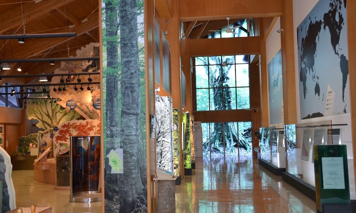
Located in Fujisato Town, the Shirakami Mountains World Heritage Center (Fujisato Hall) is a facility for learning about the nature and history of the Shirakami Mountains. Visiting before hiking to gather information or after hiking to deepen understanding of the Shirakami Mountains is ideal.
The facility features dioramas of the Shirakami Mountains, fauna and flora exhibits, and video theaters, providing detailed information on why the area received World Natural Heritage designation and the importance of its ecosystem. Hiking maps and pamphlets are also available, making it a recommended pre-hike stop.
Facility Information:
- Address: 63 Fujigoto, Tarakuri, Fujisato Town, Yamamoto District, Akita Prefecture
- Operating hours: 9:00-17:00
- Closed: Year-end and New Year holidays
- Admission: Free
Gatadai Natural Observation Educational Forest
Gatadai Natural Observation Educational Forest is a popular spot for casually enjoying beech primordial forest walks. An approximately 2km-long walking trail is maintained, creating a circuit course completable in about one hour.
Giant beech trees exceeding 300 years of age stand in rows, earning it the nickname “microcosm of the Shirakami Mountains,” condensing the Shirakami experience. Those unable to hike or families can enjoy the beech forest without mountain climbing.
During autumn foliage season, the beech forest turning golden is beautiful, making it worthwhile to visit alongside Komagatake hiking.
Subari Lake and Surroundings
Subari Lake is an artificial lake in Fujisato Town, with the surrounding area developed as Subari Park. The lakeshore features campgrounds and recreational facilities for enjoying outdoor activities in nature.
During autumn foliage season, the reflected foliage on the lake surface is beautiful, making it a popular foliage spot near Shirakami Mountains Komagatake. It serves as an excellent rest stop during drives, allowing for lakeside strolls and refreshment.
Walking trails are maintained around the lake for casual nature walks. Fishing and boating are also available, making it recommended for those wishing to enjoy activities different from mountain hiking.
Best Seasons and Climate
Spring (May-June)
Snowmelt progresses in May, marking the beginning of hiking season. This period offers beautiful fresh green foliage, with beech leaves shining in vivid green. Additionally, from April through May, the “black horse” snow pattern appears on the mountainside, allowing observation of the phenomenon that inspired Komagatake’s name.
In Tanawashiro Wetland, spring flowers like skunk cabbage begin blooming, making this ideal timing for alpine plant observation. However, residual snow may remain, so verifying current conditions before hiking is important.
Temperatures around the base range from 10-20°C, while the summit area is cooler at 5-15°C, requiring warm clothing.
Summer (July-August)
Summer is the season with the most hikers and features stable weather, making it recommended for beginners. The beech forest covers in deep green, providing cool, comfortable hiking through shaded areas.
In Tanawashiro Wetland, summer alpine plants like Japanese globeflower and cotton grass bloom, offering the “flower-filled wetland” experience. Summit views are excellent, with far-reaching vistas on clear days.
Temperatures reach 20-30°C at the base and 15-25°C at the summit. Strong sunlight demands sun protection and adequate hydration.
Autumn (September-October)
Autumn is foliage season, when Komagatake displays its greatest beauty. From late September through mid-October, beech forests turn golden, showcasing magnificent autumn colors.
Weather generally remains stable, but sunset comes earlier, requiring early departure and timely action. Morning and evening temperatures become severe, making warm clothing essential.
Temperatures range from 10-20°C at the base to 5-15°C at the summit, with wind further lowering the perceived temperature, especially at the summit.
Winter Conditions
From late November through late April, snow-covered conditions close forest roads to the trailhead. Winter hiking requires advanced winter mountaineering equipment and experience, and is not generally recommended for general hikers.
Winter Shirakami Mountains display beautiful snowy landscapes but present access difficulties and increased avalanche risk. Winter visits require thorough preparation and experience.
Hiking Preparation and Equipment
Required Equipment List
Basic Equipment:
- Hiking boots (high-cut recommended)
- Rain gear top and bottom (high water-resistance)
- Backpack (20-30L capacity)
- Hat, gloves
- Warm clothing (fleece or down jacket)
- Change of clothes (quick-dry material)
Safety Equipment:
- Headlamp (with spare batteries)
- Map, compass, GPS app
- First aid kit
- Whistle
- Portable toilet
- Bear bell
Food and Drink:
- Drinking water (1L or more)
- Trail snacks (rice balls, bread, chocolate, nuts, etc.)
- Emergency rations
Other Items:
- Sunscreen, sunglasses
- Insect repellent (summer season)
- Camera
- Garbage bag
Physical Conditioning and Training
Although Komagatake hiking is intermediate level, ascending 750m elevation gain requires considerable fitness. Preparing 1-2 months before the climb is recommended.
Recommended Training:
- Walking, jogging (3-4 times weekly, 30+ minutes)
- Stair climbing (with attention to knee strain)
- Squats, lunges for lower body strengthening
- Walking practice with light backpack load
For those without regular exercise habits, begin with flat-ground walking and gradually increase distance and intensity. Experiencing light mountain hikes several times before attempting Komagatake allows for safer, more enjoyable climbing.
Hiking Notification Submission Method
Hiking notifications (hiking plan forms) provide crucial information for rescue operations in case of accident or emergency. Always submit before entering the mountain.
Submission Methods:
- Trailhead Post: A hiking notification post is located at Kuroishi Trailhead
- Online Submission: Use hiking notification sites like “Compass”
- Police Station: Submit to the Akita Prefectural Police Headquarters or nearest police station in advance
Hiking notifications should include hiker name and contact information, hiking route, planned schedule, and emergency contacts. Remember to also submit a descent notification after completing the hike.
Nature Conservation in the Shirakami Mountains
Value as World Natural Heritage
The Shirakami Mountains received World Natural Heritage designation in 1993 because virtually untouched primordial beech forests remain at a world-class scale.
Beech forests function as “green dams,” storing abundant water and serving as habitat for diverse fauna and flora. The precious ecosystem supports thousands of species ranging from large animals like Asian black bears, Japanese serow, and golden eagles to insects and fungi.
This primordial natural environment is extremely rare globally and is recognized as humanity’s shared heritage to pass to future generations.
Hiking Etiquette and Environmental Conservation
Visiting the World Natural Heritage Shirakami Mountains requires consideration to minimize environmental impact.
Etiquette to Follow:
- Take all trash with you: Never leave trash in nature
- Don’t collect plants or animals: Don’t pick flowers or gather berries, don’t feed wildlife
- Stay on marked trails: Walk designated routes to protect vegetation
- Keep noise low: Consider wildlife and other hikers
- Avoid campfires: Prevent forest fires
- Use portable toilets: Don’t leave waste in the mountains
The Shirakami Mountains belong not just to our generation but represent precious nature to pass to future generations. Each person should act with environmental conservation in mind.
Bear Precautions and Safety Management
Asian black bears inhabit the Shirakami Mountains, with possible encounters during hiking. Appropriate measures are necessary to avoid unexpected bear encounters.
Bear Precautions:
- Carry bear bells: Continuously make noise while hiking to announce your presence
- Avoid solo hiking: Travel in groups when possible
- Avoid early morning and evening hiking: Avoid bear activity times
- Manage food carefully: Store food in sealed containers to prevent odor leakage
- If you encounter a bear: Remain calm and slowly retreat. Don’t run away.
Carrying bear spray is also an effective precaution. Learning proper response procedures in advance is recommended.
Lodging and Hot Spring Information
Nearby Accommodations
While Komagatake hiking is primarily day trips, considering overnight stays before or after climbing, lodging is available in Fujisato Town and surrounding areas.
Within Fujisato Town:
- Several private inns and pensions
- Campground at Subari Lake shore
Akita City Center:
- Multiple business hotels
- Hot spring inns
For early departures, staying overnight in Fujisato Town or nearby areas is convenient. Reservations should be made early, as the foliage season brings crowds.
Recommended Day-Use Hot Springs
Day-use hot springs near the hiking area are ideal for soothing post-hike fatigue.
Hotel Yutoria Fujisato:
A hot spring facility in Fujisato Town, approximately 40 minutes by car from the trailhead. Features large public baths and outdoor hot springs for thorough post-hike relaxation.
Hot Springs in Akita Area:
Multiple day-use hot springs exist in the Akita area, approximately 1 hour by car from the trailhead. Dining options are available at many facilities.
Check operating hours and closure days in advance if planning to visit hot springs.
Frequently Asked Questions
Can beginners climb it?
Komagatake is classified as intermediate level, but with maintained trails and basic fitness, beginners can summit. However, ascending 750m elevation gain requires conditioning, so pre-hike training is recommended for those lacking regular exercise.
First-time climbers benefit from hiking with experienced mountaineers or participating in guided tours. Choose days with good weather and aim for early departure.
When is the best autumn foliage viewing time?
Komagatake foliage typically peaks from late September through mid-October. Summit area begins coloring in late September, with mid-slope beech forests displaying most beautiful golden hues in early October.
Since viewing peaks vary yearly with temperature and weather, checking latest foliage information before visiting is recommended. Information is available through Fujisato Town Tourism Association and Shirakami Mountains World Heritage Center websites.
What is the optimal hiking departure time?
Early morning departure is recommended. Departing the trailhead at 6-7am allows summit arrival by late morning with afternoon descent. Early departure benefits include cooler, comfortable climbing conditions, avoiding afternoon weather deterioration, and reaching parking areas before crowds. Weekend foliage season crowds make early departure especially important.
Is solo hiking possible?
While solo hiking is possible, multi-person hiking is safer. Solo hikers must submit hiking notifications and inform family or friends of plans.
Since cell reception may only work near the summit, emergency communication options are limited. Always carry GPS apps and maps with constant position awareness.
Can families with children climb it?
Children in upper elementary school with regular exercise experience can summit. However, 750m elevation gain with 4-hour round-trip requires careful consideration of child fitness and experience.
Families should carefully pace the hike with frequent breaks in good weather with ample planning margins.
Is the parking lot crowded?
Weekend and holiday foliage season parking often becomes congested. With limited 20-vehicle capacity, arriving by 6am is recommended for guaranteed parking.
Weekdays and non-foliage seasons typically see lighter traffic, making mid-week visits advisable.
Conclusion
Shirakami Mountains Komagatake, as the highest peak on Akita Prefecture’s side of the World Heritage Shirakami Mountains, possesses diverse attractions including primordial beech forests, Tanawashiro Wetland alpine plants, and 360-degree summit panoramas.
At 1,158m elevation with approximately 2-hour one-way day hiking feasibility, this intermediate-level course suits experienced climbers well. Particularly during foliage season (late September through mid-October), beech forests turn golden, displaying spectacular landscapes.
When hiking, prepare appropriate equipment, always submit hiking notifications, and practice environmental consideration. While protecting this precious World Natural Heritage Site’s nature, pursue safe and enjoyable hiking.
Through Komagatake hiking, touch the mystery of ancient 8,000-year-old primordial beech forests and experience the greatness and beauty of nature. Create unforgettable mountain memories at Shirakami Mountains Komagatake, Akita Prefecture’s pride.