
Complete Guide to Kamakura-dake Yuhodo Trail (Furusaka Town, Fukushima) | Autumn Foliage, Spring Flowers, and Climbing Information
The Kamakura-dake Yuhodo Trail in Furusaka Town, Ishikawa County, Fukushima Prefecture, is a nature-rich hiking course that circles around Kamakura-dake, which stands at an elevation of 669 meters. Known not only as a famous spot for autumn foliage, but also for the spring blooms of Japanese dogtooth violets and Japanese alpine bistorta, it is cherished throughout the seasons by many climbers and nature enthusiasts.
This article provides detailed information useful for actually visiting, including the appeal of the Kamakura-dake Yuhodo Trail, access methods, best seasons, climbing routes, and surrounding information.
About the Kamakura-dake Yuhodo Trail
Kamakura-dake: Symbol of Furusaka Town
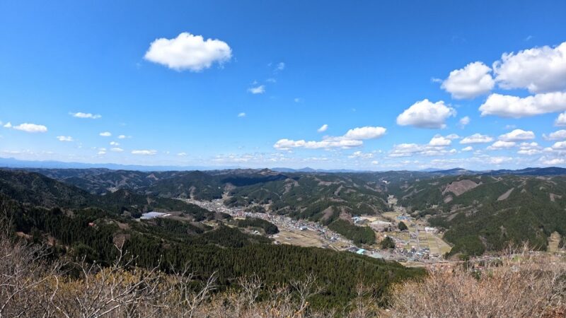
Kamakura-dake is a 669-meter-high mountain towering in the Matsukawa district of Furusaka Town, Ishikawa County, Fukushima Prefecture, and is cherished as a symbol of the town by local residents. Located in the Abukuma Highlands, the summit offers panoramic views of the surrounding mountains and the townscape of Furusaka.
There is another mountain with the same name, “Kamakura-dake,” in the Tokiwa district of Tamura City, Fukushima Prefecture (elevation 967m). Therefore, the Kamakura-dake in Furusaka Town is also called “Takenuki no Kamakura-dake” to distinguish it from the “Tokiwa Kamakura-dake” in the Tokiwa district.
Characteristics of the Trail
The Kamakura-dake Yuhodo Trail is a circular course that winds around the mountain and takes approximately 1.5 to 2 hours to complete. The path is relatively easy for beginners to walk, but there is a rocky area with chains directly below the summit, offering adequate alpine hiking experience.
Along the trail, there are giant rocks called “Tengu no Ashiato” (Tengu’s Footprints), and near the summit stands Komagata Shrine, making it a charming course where nature and history blend together.
Seasonal Highlights of the Kamakura-dake Yuhodo Trail
Spring: Colonies of Japanese Dogtooth Violets and Japanese Alpine Bistorta
The Kamakura-dake Yuhodo Trail is also famous as a spring flower hotspot. Particularly around mid-April, colonies of Japanese dogtooth violets and Japanese alpine bistorta reach their peak bloom.
Japanese dogtooth violets are representative spring alpine wildflowers with delicate purple blossoms, and the sight of them growing in colonies on the slopes along the trail is breathtaking. The blooming period is short and easily affected by temperature and weather, so timing is important for a visit.
Japanese alpine bistorta is a perennial with pale pink flowers that grows in rocky areas and under trees. Since it blooms at the same time as the dogtooth violets, being able to enjoy both flowers simultaneously is a major attraction of the Kamakura-dake Yuhodo Trail.
During the spring flower season, many photography enthusiasts and plant observers visit. Taking photographs in the morning light will yield even more beautiful pictures.
Autumn: Stunning Autumn Foliage Scenery
The Kamakura-dake Yuhodo Trail is known as one of Fukushima Prefecture’s premier autumn foliage spots. The typical viewing season is from late October to mid-November.
Japanese maples, maples, oaks, and beeches turn red and yellow, creating beautiful landscapes that contrast with the rocky surfaces. The views from the summit area are particularly spectacular, offering a panorama of the autumn landscape of the Abukuma Highlands with mountains dyed in red and yellow.
Walking the trail and passing through tunnels of trees colored in crimson and gold is a deeply moving experience for visitors. The autumn mountain path, with fallen leaves underfoot, is a luxurious time to feel the season with all five senses.
The autumn foliage season draws many tourists, so parking lots can become congested on weekends and holidays. An early morning visit is recommended.
Summer: New Greenery and Forest Bathing
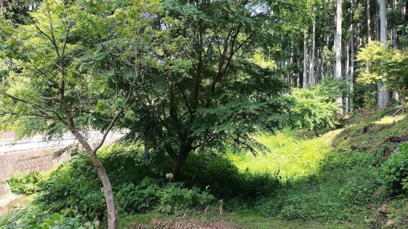
The Kamakura-dake Yuhodo Trail in summer is an ideal forest bathing spot enveloped in deep green. Due to the relatively low elevation, it can get hot in midsummer, but there is plenty of shade and areas where cool breezes pass through.
You can enjoy hiking slowly while listening to the calls of cicadas and the songs of wild birds.
Winter: Peaceful Mountain Walking
In winter, there is snowfall and fewer visitors, but the experience of walking through silent, snow-covered landscapes is special. However, since the path surface can freeze, winter mountain equipment and sufficient experience are necessary.
Detailed Climbing Routes
Standard Circular Course
The standard course for the Kamakura-dake Yuhodo Trail is as follows:
Parking area (approx. 500m elevation) → (approx. 20 minutes) → Tengu no Ashiato → (approx. 60 minutes, right-hand route) → Gazebo → (approx. 40 minutes) → Komagata Shrine → (approx. 10 minutes) → Summit (669m elevation) → (approx. 10 minutes) → Tengu no Ashiato → (approx. 15 minutes) → Parking area
Total time: Approximately 1.5 to 2 hours
Total distance: Approximately 2.6 km
Cumulative elevation gain: Up approximately 234m, down approximately 234m
Clockwise and Counterclockwise Routes
Since the trail is circular, you can walk it either clockwise (right-hand route) or counterclockwise (left-hand route). Most climbers tend to take the clockwise route.
The clockwise route begins with relatively gentle terrain and has a steep ascent to the summit in the latter half. The counterclockwise route tackles the steep section first and descends via the gentler path. You can choose based on your fitness level and preferences.
Explanation of Major Points
Trail Entrance
A few minutes’ walk from the parking area, you’ll find a sign marking the trail entrance. The official mountain path begins here. In spring, Japanese dogtooth violets and Japanese alpine bistorta can be seen in this area.
Tengu no Ashiato (Tengu’s Footprints)
An unusual rock formation with indentations resembling footprints, this is one of the highlights of the trail. According to legend, these are the footprints left when a tengu took flight.
Gazebo
A rest area at the midpoint of the course. There are benches where you can rest while enjoying the scenery.
Komagata Shrine
A small shrine located just below the summit. Many climbers pray here for safe climbing.
Summit
From the 669-meter summit, a 360-degree vista opens up, and on clear days, you can see the surrounding mountains and the townscape of Furusaka.
Chains and Rocky Areas
There is a rocky area with chains installed just below the summit. Whether approaching from the Komagata Shrine side or the Tengu no Ashiato side, you must climb the steep rock face using chains.
The rocky area becomes slippery when wet, so extra caution is needed during rain or immediately after rainfall. Grip the chains firmly and maintain three-point contact (always keeping three of your four limbs in contact with the rock), and climb carefully.
For beginners or those uncomfortable with heights, it is recommended to climb with companions.
Access Information
Access by Car
Via Tohoku Expressway
- From Sukagawa IC via National Route 118 and Prefectural Route 14, approximately 55 minutes (approximately 40 km)
- From Shirakawa IC via National Route 289 and Prefectural Route 14, approximately 60 minutes
Via Abukuma Kogen Road
- From Ishikawa-Motoabara IC via Prefectural Route 14, approximately 30 minutes (approximately 20 km)
GPS Navigation Settings
Address: Furusaka Town, Ishikawa County, Fukushima Prefecture, Matsukawa, Ninai
Search for “Kamakura-dake Trail Entrance Parking Area” or “Kamakura-dake Yuhodo Trail”
Parking Information
There is a free parking lot at the Kamakura-dake trail entrance.
- Capacity: Approximately 15-20 cars
- Fee: Free
- Restroom: Available (simple toilet)
The lot may fill up on weekends and holidays during the autumn foliage season, so early arrival is recommended. It is a short walk from the parking area to the trail entrance.
Access by Public Transportation
Using JR Suigoku Line
From JR Bakujo Ishikawa Station by taxi, approximately 40 minutes (approximately 25 km)
Public transportation access is inconvenient, so the use of a rental car or advance reservation with a local taxi company is recommended.
Contact Information
Furusaka Town Office: 0247-53-4613
(You can check information about trail conditions and snow coverage)
Preparation and Precautions for Climbing
Clothing and Equipment
Basic Equipment
- Hiking boots or trekking shoes (sneakers are possible, but shoes with sturdy soles are recommended due to rocky terrain)
- Backpack (for day use, approximately 20-30 liters)
- Drinking water (500ml-1 liter)
- Snacks (rice balls, bread, energy bars, etc.)
- Rain gear (rain jacket and pants)
- Warm clothing (essential in fall and winter; bring even in spring and summer as it can be windy at the summit)
- Map and compass (or smartphone map app)
- Headlamp (in case the hike takes longer than planned)
- First aid kit
Seasonal Precautions
- Spring: Bring warm clothing as mornings and evenings are cold
- Summer: Hat, sunscreen, and sufficient water for heat exhaustion prevention
- Autumn: Early morning departure is recommended as the foliage season is crowded
- Winter: Winter mountain equipment such as crampons and snowshoes are necessary due to snow and ice
Climbing Notice and Safety Measures
Although Kamakura-dake is a relatively low mountain with a day-use hiking course, inform family and friends of your destination and expected return time for safety.
Climbing with multiple people is safer than solo climbing. Cell phone reception is usually available near the summit, but dead zones can occur in valleys.
Etiquette and Rules
- Always take your trash with you
- Plant collection is prohibited (including dogtooth violets and alpine bistorta)
- Avoid venturing off the designated trail
- Greet others you pass and show mutual consideration
- If you encounter wildlife, do not disturb it and maintain a safe distance
Nearby Tourist Attractions
Highlights in Furusaka Town
Koshidai Sakura (Koshidai Cherry Blossom)
An ancient Yamato cherry with a tree age of about 400 years, designated as a natural monument of Fukushima Prefecture. In spring, many flower-viewing visitors come.
Furusaka Hachiman Shrine
A historic shrine in Furusaka Town where the autumn festival is held annually.
Michi-no-Eki Furusaka Ofirokuno Eki (Roadside Station)
Fresh local agricultural products and specialties can be purchased. There is also a dining area where you can enjoy local cuisine.
Hot Spring Facilities
Hot springs are available nearby to soothe fatigue after climbing.
Iwaki Yumoto Onsen
A historic hot spring about 1 hour’s drive away.
Bohatara Onsen
A hot spring in Ishikawa Town with comprehensive day-use bathing facilities.
Best Seasons and Crowds
Spring (Mid-April to Early May)
Season for Japanese dogtooth violets and alpine bistorta blooms. The flower viewing period is short, so checking bloom information before visiting is recommended. Weekends are crowded, but not as much as the autumn foliage season.
Summer (June to August)
New greenery is beautiful and relatively uncrowded. However, heat precautions are necessary in midsummer.
Autumn (Late October to Mid-November)
The busiest time of year as the autumn foliage season. Especially from late October to early November, parking lots may fill up on weekends and holidays. Early morning arrival (around 7-8 AM) is recommended.
Winter (December to March)
Snow falls and fewer people visit. Best for experienced winter mountaineers.
History and Culture of the Kamakura-dake Yuhodo Trail
Mountain Worship and Komagata Shrine
Komagata Shrine, enshrined near the summit of Kamakura-dake, has long been an object of mountain worship in the region. Komagata Shrine is revered as the guardian deity of horses, and people have visited to pray for agricultural and traffic safety.
Origin of the Name
There are several theories about the origin of the name “Kamakura-dake,” including that the mountain’s shape resembles mountains in Kamakura, or that there is a legend related to the Kamakura period.
Photography Spots
Tengu no Ashiato (Tengu’s Footprints)
This unique rock formation offers interesting photographic opportunities. Capturing the rock’s indentations together with the surrounding forest creates an atmospheric image.
View from the Summit
On clear days, a 360-degree vista opens. Especially during the autumn foliage season, you can photograph the spectacular scenery of mountains colored in shades of fall.
Colonies of Dogtooth Violets and Alpine Bistorta
Close-up spring flower photography is enhanced with a macro lens. Photography in the soft morning light is recommended.
Frequently Asked Questions (FAQ)
Can beginners climb this mountain?
Yes, beginners can. The entire trail is well-maintained, but there is a rocky area with chains directly below the summit. With basic climbing equipment and careful behavior, there should be no problems. If uncertain, it is recommended to climb with experienced companions.
How long does it take?
The full circle takes approximately 1.5 to 2 hours. Including photography and rest, allow about 2.5 hours to enjoy it comfortably.
Is the parking free?
Yes, it is free. There is space for approximately 15-20 cars. The lot gets congested on autumn foliage weekends, so early morning arrival is recommended.
When is the autumn foliage viewing season?
The typical season is from late October to mid-November. This varies year to year, so checking the latest information with Furusaka Town Office or tourism associations before visiting is recommended.
When can I see the dogtooth violets and alpine bistorta?
Mid-April is the typical viewing time. Since the blooming period is short and affected by weather, it is recommended to check local bloom information before visiting.
Can I bring pets?
There are no specific prohibitions, but for consideration of other hikers and pet safety, keep pets on a leash and follow proper etiquette. Some rocky sections may be difficult for small dogs.
Are there restrooms?
There is a simple toilet at the parking area. Since there are no restrooms along the trail, please use facilities before departure.
Can I climb in winter?
Winter climbing requires winter mountain equipment and experience due to snow and ice. Beginners should avoid winter climbing.
Conclusion
The Kamakura-dake Yuhodo Trail is a charming hiking course that circles around 669-meter-high Kamakura-dake in Furusaka Town, Fukushima Prefecture. It captivates visitors with spring Japanese dogtooth violets and alpine bistorta blooms, autumn foliage, and beautiful nature enjoyed year-round.
While it is a manageable course that can be completed in 1.5 to 2 hours, it also offers sufficient alpine hiking experiences with its rocky terrain with chains and summit views. It is recommended for everyone from beginners to experienced climbers and is a hidden gem in Fukushima Prefecture.
The Kamakura-dake Yuhodo Trail displays a different face in each season. Please visit and see its beauty for yourself. The rich nature of Fukushima Prefecture will surely welcome you warmly.
-800x450.jpg)
-800x450.jpg)